
Drone Integration Work at NY UAS Test Site
CAL Analytics • April 13, 2020
CAL Analytics to Lead Development and Testing of UTM Contingency Management Platform at Griffiss International Airport
Syracuse, NY – The Federal Aviation Administration (FAA) recently awarded a $1.6M contract that will advance unmanned traffic management (UTM) at the New York (NY) Unmanned Aircraft Systems (UAS) Test Site. CAL Analytics will lead a team of five commercial
companies in the development of a single, integrated contingency management platform (CMP) for unmanned aircraft integration. Together with NUAIR and Oneida County, the companies will integrate and test their CMP technology to address specific safety and risk mitigation concerns for operating UAS in the national airspace the NY UAS Test Site.
“We’re excited to work directly with the FAA to bring together some of the most innovative companies in the industry to tackle operational safety in UTM,” said Dr. Sean Calhoun, Managing Director of CAL Analytics. “Validating a contingency management approach is a critical, but often overlooked, step to achieve routine commercial drone operations."
Cyber-physical systems-of-systems, like UTM, rely on a multitude of data from various sources to make decisions, often with real-world safety implications. The CMP will offer important protection protocols and situational awareness, alerting operators of faults, failures, and severe weather to help ensure the safe flight of all unmanned aircraft.
CAL Analytics will lead system integration which combines:
- Monitoring and mitigation software from ResilienX, of Syracuse, NY;
- Cybersecurity software provided by Assured Information Security (AIS) of Rome, NY;
- Situational awareness display systems from Kongsberg Geospatial of Ottawa, ON;
- Micro-weather services from TruWeather, also of Syracuse, NY
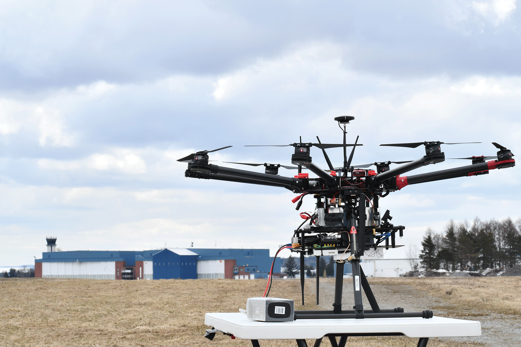
Validation testing will be managed by NUAIR who manages operations at the Oneida County-owned New York UAS Test Site at Griffiss International Airport in Rome, NY, one of just seven FAA-designated UAS test sites in the United States. The team will also leverage the state’s 50-mile UAS Corridor installed with radars and advanced technologies to facilitate advanced drone operations.
“This partnership further solidifies Oneida County’s UAS Test Site as the global leader in industry research and advancement,” said Oneida County Executive Anthony J. Picente Jr. “The unmanned traffic management corridor we have been establishing from Rome to Syracuse is laying the groundwork for the future of UAS deployment, performance, safety and delivery capabilities.”
“Having a reliable UTM health and monitoring function is a key element in the safe integration and commercialization of unmanned aircraft,” said Andy Thurling, chief technology officer at NUAIR. “CAL, ResilienX, and TruWeather continue to be integral partners of NUAIR and the New York UAS Test Site, and we look forward to advancing routine, commercial UAS operations utilizing this program.”
Andrew Carter, President and CTO of ResilienX said, “Performance Authorizations, identified in v2 of the FAA’s UTM CONOPS will lead to scalable, routine commercial drone operations, a goal of the UAS corridor in New York. ResilienX is providing safety assurance though health monitoring and fault mitigation software to maintain a safe level of performance through encountered faults, failures or adverse conditions, enabling these complex ecosystems.”
TruWeather Solutions will deploy its dynamic platform that collects and presents real-time, predictive micro-weather analytics and insights. "TruWeather is excited to build and demonstrate our weather hazard notification services,” said CEO, Don Berchoff. “The CMP will monitor our scalable and agile TruFliteTM alert service to notify UTM providers and operators of emerging adverse conditions to alert specific drone types to take evasive action. The power of the service is other drones, not similarly impacted by the conditions, can continue flying.”
“AIS is thrilled to be a part of this FAA sponsored program in ensuring the cybersecurity of UTM, as a predicate for safe routine operations of UAS in the national air space,” said Scott Robidoux, chief operating officer at AIS. “AIS is leveraging its industry leading capabilities to provide the necessary cybersecurity performance monitoring of the UTM as part of its overall health and integrity.”
Kongsberg Geospatial will deploy IRIS UxS, a real-time airspace visualization system for beyond visual line-of-sight (BVLOS) mission management that allows a single operator to manage multiple aircraft. The system combines real-time data from a variety of sensors to create a real-time picture of the airspace where UAS are being operated.
“For the past few years, we’ve been working on improving safety for BVLOS UAS missions through the development of IRIS UxS,” explains Kongsberg vice president, Paige Cutland. “The IRIS system is now actively deployed for a variety of long-range mission applications including drone delivery, pipeline inspection, and emergency airspace operations.”
The contract is part of the FAA’s efforts to perform vital drone integration safety work at the FAA’s federally-designated UAS test sites. The project was awarded after a competitive acquisition process and intended for “qualified companies who can work at FAA UAS testing
sites to forward essential integration technologies such as sense and avoid capabilities, geofencing, and unmanned traffic management (UTM.)”
###
The milestone strengthens CAL’s AtlasAI platform for safer, scalable BVLOS drone operations under the FAA’s proposed Part 108 framework.
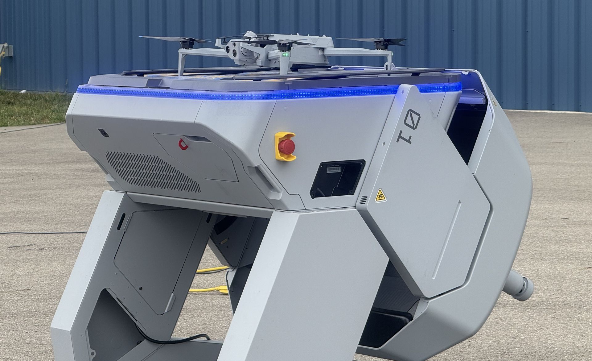
COLUMBUS, OH (February 9, 2026) — Ohio continues to lead the nation in modernizing emergency response with the selection of nine public safety agencies to participate in the Ohio Statewide Drone First Responder (DFR) Pilot Program , a first-of-its-kind initiative designed to expand rapid aerial response capabilities across communities of all sizes. The program, led by the Ohio Department of Transportation (ODOT) and DriveOhio, with program management support from SkyfireAI, reflects Ohio’s commitment to equipping first responders with innovative tools that improve situational awareness, enhance officer and responder safety, and reduce emergency response times. The following agencies have been selected to participate in the pilot program: City of Springfield Police/Fire/EMS Athens Police Department Lima Police Department Toledo Police Department Violet Township Fire/EMS Austintown Fire Department City of Hamilton Police/Fire/EMS Amherst Police Department Kelleys Island Fire/EMS Together, these agencies represent a diverse cross-section of Ohio, spanning urban centers, suburban communities, and rural jurisdictions — reinforcing the program’s goal of ensuring access to advanced emergency response capabilities statewide. Many of the selected agencies have also committed to sharing drone resources with neighboring jurisdictions, further expanding the impact of this program. “Ohio is committed to giving our first responders the tools they need to protect lives and serve their communities safely and effectively,” said Governor Mike DeWine . “This statewide Drone First Responder pilot reflects Ohio’s leadership in innovation, our strong partnership with local agencies, and our focus on using technology responsibly to support public safety across the state.” Created under Ohio House Bill 96, the Ohio Statewide DFR Pilot Program enables participating agencies to deploy state-approved, NDAA-compliant drone systems capable of rapid launch, real-time video streaming to command staff, and integration into Ohio’s emerging uncrewed aircraft traffic management framework, led by Ohio-based CAL Analytics. “We are enthusiastic supporters of DFR program and thankful for the efforts of so many Ohio leaders to accelerate this program into the execution phase,” said State Representative Adam Holmes , who championed the program's inclusion in the bill. “The DFR program will greatly enhance first responder effectiveness and will provide increased support for all Ohioans. A tremendous capability for our priceless first responders.” “Ohio is leading the way for the nation with the first statewide DFR program! Our ODOT leaders are setting the stage for an integrated network of DFR assets that will undoubtedly save lives and resources and be a force-multiplier for our undermanned first responder organizations,” said State Representative Bernard Willis , Chair of the House Transportation Committee. “In Ohio, the HOME of aviation we are the BEST at making historic innovations with flying machines, and we will NEVER stop leading the way!” With technology known as drone-in-a-box, a drone can be launched from a permanent docking site and be flown remotely to a scene. These pre-positioned drones provide real-time visual information to aid decision-making, and some can also drop critical medical supplies to the scene of an emergency. The program emphasizes operational readiness, standardized training, and responsible use, while maintaining a strong focus on community engagement and transparency. “This program is about thoughtful implementation, not experimentation,” said Richard Fox, Director of the DriveOhio UAS Center . "By coordinating procurement, training, and regulatory support at the state level, Ohio is creating a scalable model that benfits communities of every size. We're grateful for the confidence the legislature has in ODOT to execute this groundbreaking program." SkyfireAI, a national leader in public safety drone program development and FAA regulatory integration, is supporting the initiative as program manager, working closely with ODOT, DriveOhio, and participating agencies to ensure consistent standards and successful deployment. “The selection of these nine agencies reflects the strength of Ohio’s public safety community and the seriousness with which this program has been approached,” said Don Mathis, Co-Founder and CEO SkyfireAI . "This pilot lays the foundation for how states can responsibly scale DFR programs today — and prepare for future capabilities as technology continues to evolve." Selected agencies will participate in a structured onboarding process beginning in early 2026, including hands-on vendor demonstrations, training, and program coordination. Operations are expected to begin in Spring 2026 and continue for approximately a year. The pilot program will evaluate operational effectiveness, response outcomes, and opportunities for future expansion. Ohio’s Statewide Drone First Responder Pilot Program has already drawn national attention as a potential blueprint for other states seeking to modernize emergency response while maintaining strong governance, safety, and public trust. ### About CAL Analytics: CAL Analytics is a small business focusing on the development of aviation and autonomous systems. Located in Dayton, OH and founded in 2010, CAL has expertise in navigation systems, remote sensing, signal analysis, and information fusion. CAL is a leader in UAS Traffic Management (UTM) and Advanced Air Mobility (AAM) technology, offering airspace management, mission management, detect and avoid, and in-time system-wide safety assurance (ISSA) solutions. Our mission is to provide agile and rigorous approaches to bring new technologies to the world. More information at calanalytics.com About SkyfireAI: SkyfireAI is an AI-native drone technology company redefining mission-scale autonomy for public safety, defense, and enterprise markets. Our cloud-connected and edge-enabled software platform powers autonomous swarming, Beyond Visual Line of Sight (BVLOS) operations, and real-time AI analytics—unlocking faster response, smarter decision-making, and safer operations. Built for scalability, SkyfireAI’s solutions deliver repeatable, high-value outcomes across thousands of missions, positioning the company to capitalize on a rapidly expanding global uncrewed systems market projected to exceed $100 billion by 2030. More information is available at skyfireai.com . About ODOT’s DriveOhio Initiative: DriveOhio is the state’s center for smart mobility, advancing connected, automated, shared, and electric transportation. The UAS Center, located in Springfield, OH, is the statewide resource for uncrewed aircraft systems testing, integration, and operations.
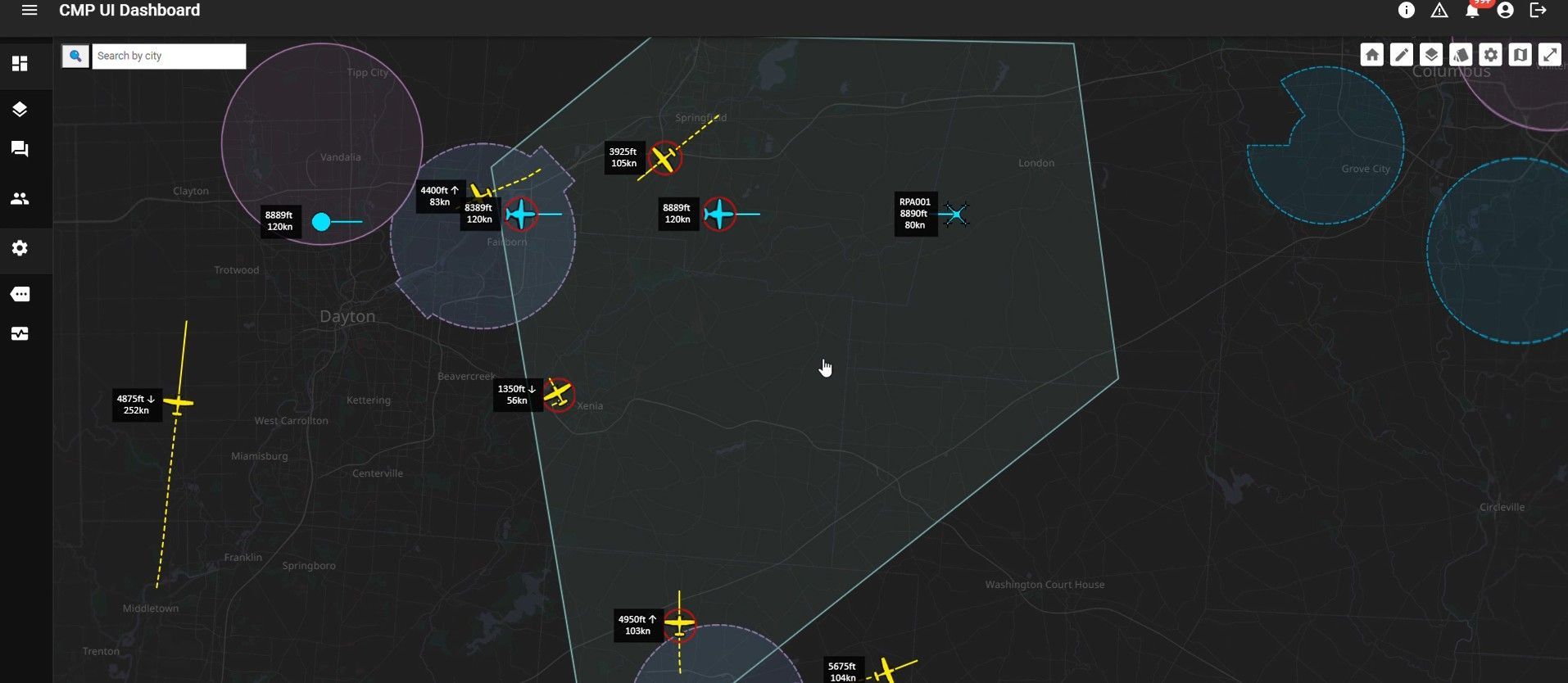
SPRINGFIELD, Ohio – January 27, 2026 – CAL Analytics, an innovator in advanced airspace management technologies, and AeroVironment, Inc. (“AV”) (NASDAQ: AVAV), a global defense technology leader delivering software-enabled disruptive autonomous systems, today announced the completed installation and initial operation of a new Beyond Visual Line of Sight (BVLOS) airspace management facility at the National Advanced Air Mobility Center of Excellence (NAAMCE) at Springfield-Beckley Municipal Airport in Springfield, Ohio. Initially developed under a Cooperative Research and Development Agreement (CRADA) between the Air Force Research Laboratory (AFRL) and the Ohio Department of Transportation (ODOT), the project now features an upgraded installation that integrates AV_Halo™ COMMAND, AV’s command and control (C2) architecture, with CAL Analytics’ Advanced Air Mobility (AAM) enterprise platform to establish the nation’s premiere test environment and management facility, where Department of War operators can safely conduct BVLOS missions in shared airspace utilizing existing Federal Aviation Administration (FAA) ground radar feeds. “This installation establishes the blueprint for how airports and states across the country can safely integrate uncrewed aircraft into existing airspace,” said Wahid Nawabi, Chairman, President and Chief Executive Officer at AV. “As the FAA defines the future of BVLOS rule-making, this facility provides the real-world operational data, safety validation, and interoperability framework regulators need. The system we’ve installed in Ohio isn’t just a mock-up or a test site — pending FAA approval it will be an operational and scalable model for nationwide deployment and the foundation for truly integrated air mobility.” The integration will support flight tests, evaluation, and day-to-day operations by routing AFRL’s access to the FAA’s ground-radar network through AV_Halo™ COMMAND — AV's modular, software-driven C2 architecture that fuses multiple enhanced sensor feeds, into a single, secure operating picture, giving operators continuous situational awareness for BVLOS mission planning and airspace safety. “AV_Halo is the connective tissue that turns a collection of sensors, radars, and platforms into a living, breathing airspace system,” said Stephen Lloyd, Senior Director C2, CUAS, and Tracking at AV. “By fusing FAA ground radar, and COTS surveillance sensors into a single, secure operating picture, AV_Halo delivers the assured visibility and machine-speed decision support needed for predictable BVLOS operations—and makes it possible to scale effortlessly from a single site to an entire statewide corridor.” When combined with CAL Analytics’ AAM enterprise platform, the system unifies radar and advanced DAA into a single real-time airspace view—enabling detect-and-avoid, extending autonomous BVLOS operations with precision and confidence. “Beyond Visual Line of Sight operations are the key to unlocking the next generation of air mobility,” said Dr. Sean Calhoun, Managing Director of CAL Analytics. “This facility will prove that BVLOS can be executed safely and reliably in shared airspace—and that matters because it sets the foundation for statewide corridors, national standards, and an entirely new layer of transportation infrastructure that will reshape how we move people, goods, data, and critical services across the country.” Pending full FAA approval, the facility will support local missions and real-time monitoring of UAS activity as AFRL, ODOT, the FAA, AV, and CAL Analytics collaborate to validate airspace-safety technologies, advance air-mobility corridors, drive economic development, and shape national BVLOS rules and integration standards. Plans are already underway to extend the system to enable corridors between Springfield and Columbus, Ohio, adding new radar sites and expanding detect-and-avoid coverage to support broader BVLOS operations across Ohio and additional sites nationwide.